

KVR Map Series
$59.00
Set of 3 x 2-sided full colour maps + 1 x 1-sided route overview map – includes shipping within Canada (please inquire for any extra shipping charges to the USA).
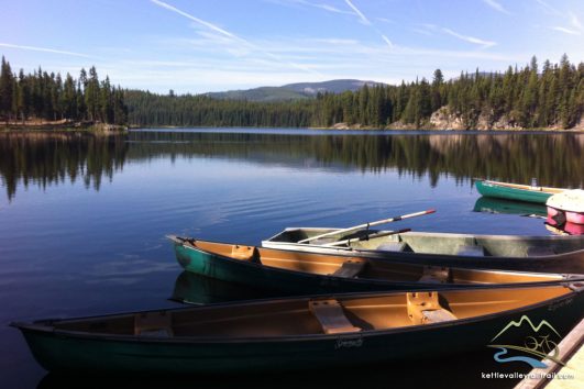
Kettle Valley Rail Trail maps are large scale, (11″ x 17″) full colour, detailed maps. KVR Map Series Midway to Penticton and the Southern Spur Route to Osoyoos.
Out of stock
| Categories: | Cycling, Maps |
|---|---|
| Tags: | cycle tours British Columbia, cycling the KVR, kettle valley railtrail, Kettle Valley Railtrail maps, Kettle Valley Railway maps, Kvr cycle tour 2023, KVR Maps |
Yes! our beautiful full colour map sets are now revised, printed and in stock!
All maps are shipped via Canada Post/mailing tube.
Our Kettle Valley Rail Trail maps are large scale, (11″ x 17″) full colour, detailed maps and designed specifically for cyclists to find their way along the trail and to adjacent towns & accommodation. Each set contains 4 pages (3 x 2-sided and one overview map 1-sided)of full colour maps from Midway to Penticton and the Southern Spur route to Osoyoos plus a separate overview map of the route.
They include applicable detours and routes off the KVR into towns as well as campsites, information and the old station points and points of interest.
They make beautiful souvenirs or gifts and are definitely frame-able.
- The series covers the KVR “Carmi subdivision” in Maps 1-3 (3 x 2-sided pages): Midway to Beaverdell/Beaverdell to McCulloch Lake (includes Myra Canyon), McCulloch Lake to Chute Lake (includes Myra Canyon)/Chute Lake to Penticton and the City of Penticton/Penticton to Osoyoos (Southern Spur route and the KVR route and detour through Penticton)
- plus 1 single sided overview map of the entire route
- 4 full colour sheets/7 maps total in each set.
Related Products
Origins: River-Forest Journey
Discovery by bike – an incredible diversity of landscape and nature.


KVR Custom Trips
Custom Tours from Castlegar to Midway, Rock Creek to Penticton, south to Oliver & Osoyoos. Build your own!
Tour Reviews
There are no reviews yet.
Leave a Review